Alastair and I had been interested in exploring more of Utah, so when I was looking at trail races for 2021 the Vacation Races Bryce Canyon event was at the top of the list. We left four days before the race, which was on May 29, spent the first two nights in Flagstaff, then drove through Lake Powell (where we both did the Vacation Races half marathon in 2018) to Hatch, Utah.
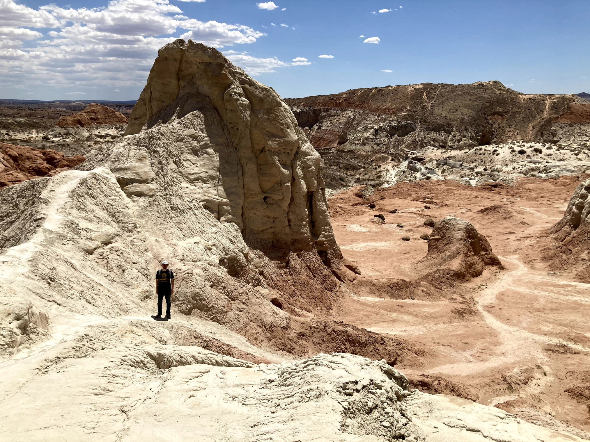
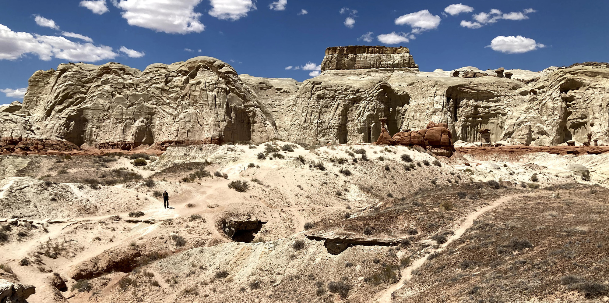
On the way to Hatch, we made a stop for a short hike to the Toadstool Hoodoos, part of the Grand Staircase Escalante National Monument in southern Utah. It’s difficult to appreciate these extraordinary formations from the road, so it was well worth checking them out. The base of Toadstool Hoodoo is Entrada sandstone and the caprock is Dakota sandstone. Over time, we’re talking over 100 million years, erosion has worn away the softer Entrada while much of the harder Dakota remains.

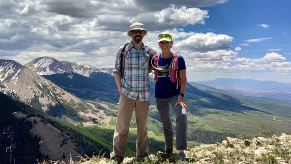
Although my race was billed as Bryce Canyon it wasn’t in the National Park, so the day before we did a 6 mile hike through the canyon, leaving from Bryce Point just after sunrise. Our hike took us down into the canyon and back up to Sunrise Point, for a total elevation gain of about 1000 feet. Had we not done this stunning hike I would have been disappointed – the race route didn’t go through any of these iconic formations.


My race was on Saturday the 29th (which you can read about in my previous blog), and we left Hatch the next day, making several stops on our way to Moab along the scenic Highway 12 – the most notable being a 3.5 mile hike in Kodachrome Basin State Park. “Geologists believe Kodachrome Basin State Park was once similar to Yellowstone National Park with hot springs and geysers, which eventually filled up with sediment and solidified. Through time, the Entrada sandstone surrounding the solidified geysers eroded, leaving large sand pipes. Sixty-seven sand pipes ranging from two to 52 meters have been identified in the park.” [Wikipedia]


We made a few other brief stops on the way to Moab, constantly amazed by the geologic diversity and the beautiful contrasts of multi-colored sandstone. Our drive took us through part of Capitol Reef National Park, established in 1971 to preserve 241,904 acres of desert landscape. We hope to explore more of it on a future trip.
We spent our first full day in Moab relaxing. I’m usually the most fatigued two days after a race, and we both welcomed some down time and a great meal at a nearby Vietnamese inspired restaurant, 98 Center (the vegan Bánh mì nachos were amazing!).
On Tuesday, June 1, we were out before sunrise to hike the 8 mile Devil’s Garden Loop trail in Arches National Park, a 73,234-acre wonderland of eroded sandstone fins, towers, ribs, gargoyles, hoodoos, balanced rocks, and, of course, arches. The trail had about 1000 feet of elevation gain, with part of it considered “primitive” (a lot of scrambling up and down rocks, and some trail sections not well marked).


We had arrived at the trailhead before 6am, and there were only a few cars in the lot at the trailhead. (Totally worth getting up at 3:30am.) When we left the park around 11am, visitors were lined up waiting for parking spaces, and the entrance had been temporarily closed due to overcrowding!
The next day was another early one – we headed to Canyonlands National Park to catch sunrise at the famous Mesa Arch, and fortunately got the last parking space at the trailhead lot. It’s difficult to get a great shot of the arch with so many other people there taking photos, but we managed to get a few.


Our next stop was Grand View Point Overlook, which is the southernmost point along the Island in the Sky scenic drive. The Colorado River and its tributaries divide the park into four districts: Island in the Sky, The Needles, The Maze, and the rivers themselves. It’s impossible to see the entire park in a day, so we chose to explore the closest region to Moab.


Heading back north, our next hike was at Aztec Butte and the Anasazi Graneries, which date to AD 1200–1300, and are one of the few ancient relics on the generally arid and uninhabited plateau between the Green and Colorado river. Most of the Anasazi settlement was lower down, nearer to reliable water sources, and they would climb up to the plateau just to collect food, storing it in protected sites such as those along the butte. The first half-mile of the trail is through flat grassland, followed by a quarter-mile scramble with 200-feet gain, which leads to the top of the butte and the granaries.


For our last hike of the morning, we chose Upheaval Dome. “Canyonlands is a place of relative geologic order. Layers of sedimentary deposits systematically record chapters in the park’s past. With some exceptions, these layers have not been altered, tilted or folded significantly in the millions of years since they were laid down by ancient seas, rivers or winds. Upheaval Dome is quite a different story. In an area approximately three miles (5 km) across, rock layers are dramatically deformed. In the center, the rocks are pushed up into a circular structure called a dome, or an anticline. Surrounding this dome is a downwarp in the rock layers called a syncline.”


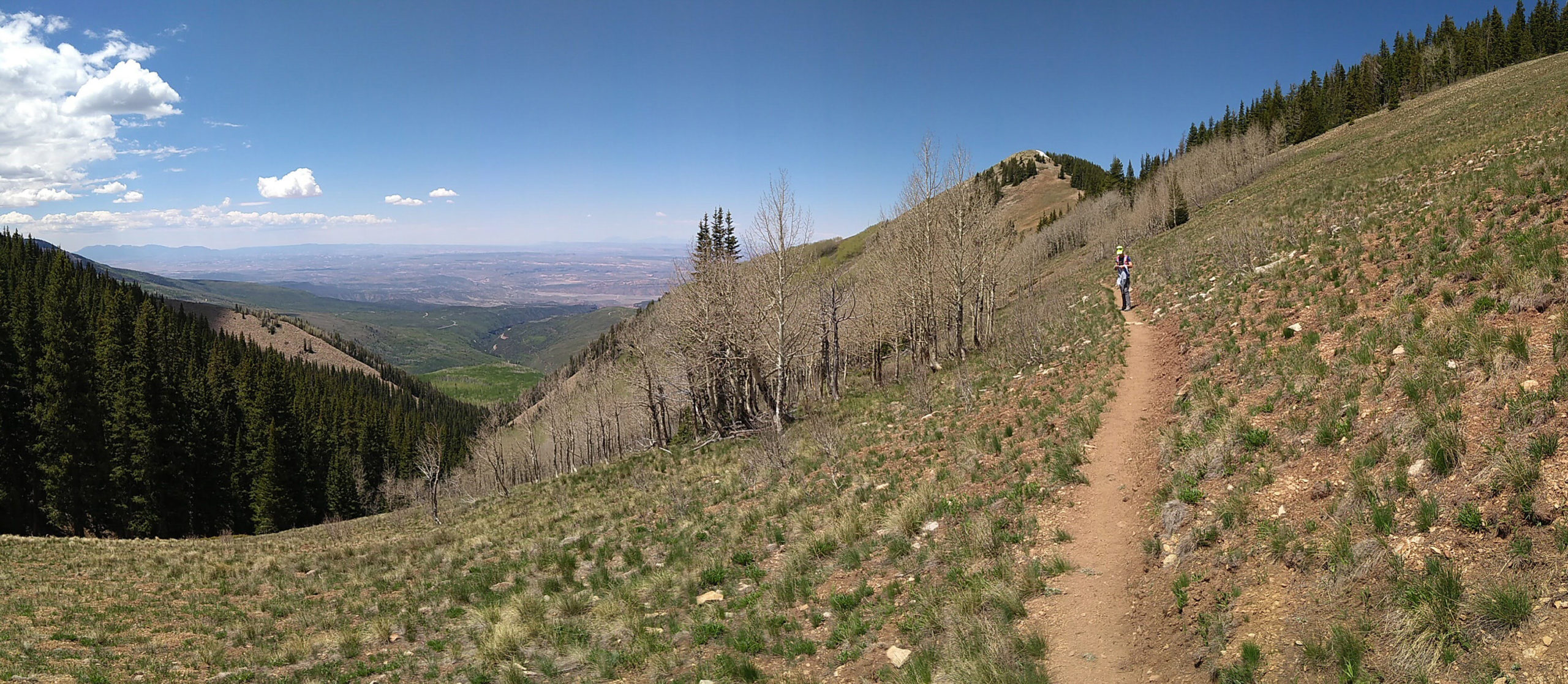
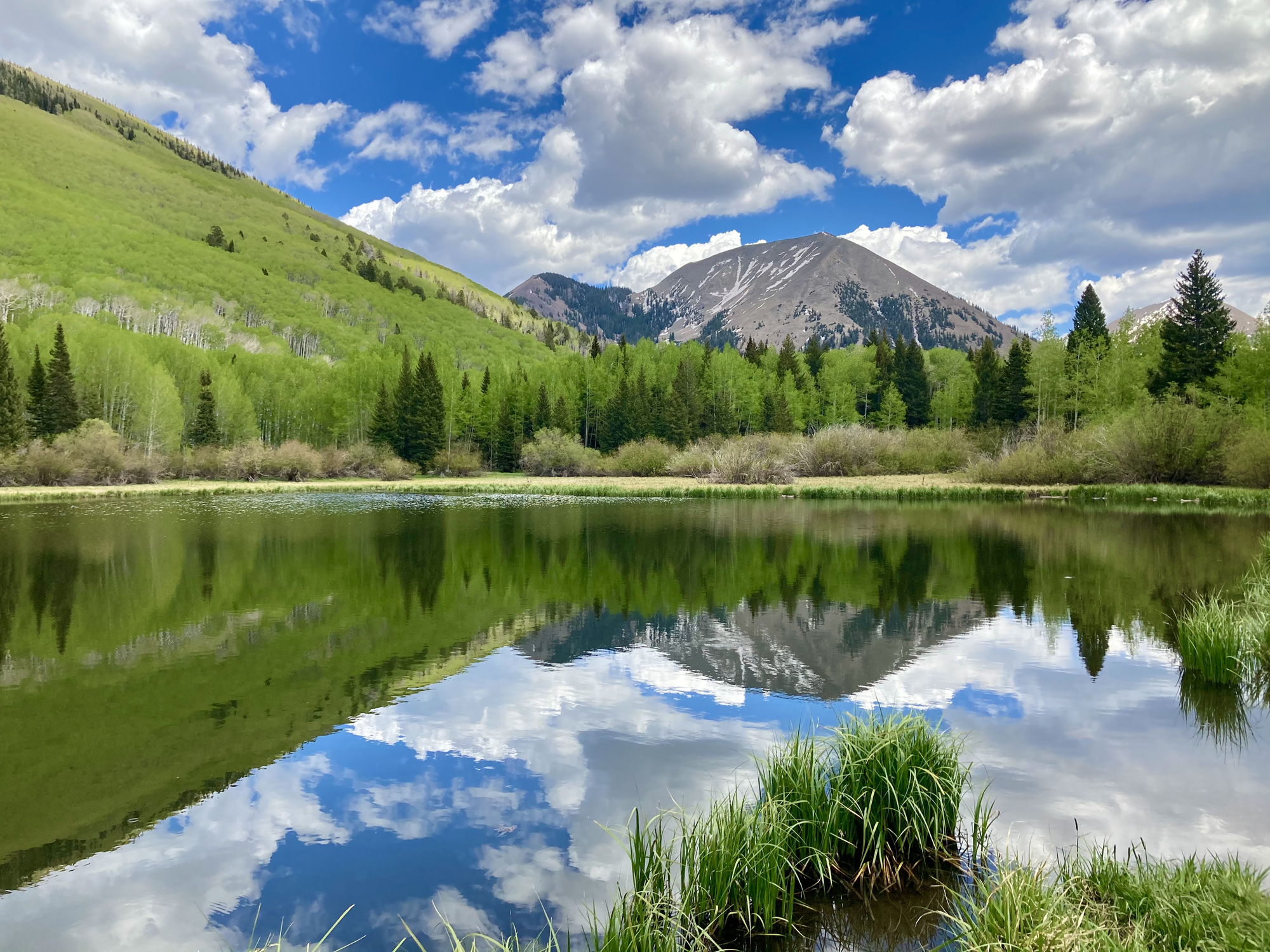
Our last full day in Moab was Thursday, June 3, which was forecasted to reach at least 100F. To escape the heat, we headed to the nearby La Sal Mountains, which are on the border between Utah and Colorado. The highest peak, Mount Peale, reaches 12,721 feet (3,877 m) above sea level. Starting at the south end, we drove the stunning La Sal Mountain Loop scenic loop, with its incredible views over the Moab Valley. Late morning, we hiked the Gold Knob Trail – 5 miles round trip with about 2000 feet of elevation gain, summiting at about 11,000 feet. From the top of Gold Knob there are outstanding views looking out over the areas surrounding Moab, including Arches National Park, Canyonlands National Park and Dead Horse Point State Park. We were amazed that we saw only a few other people on the trail, it was so gorgeous and cool (and yes, there was still snow at the top)!


We left Moab on Friday, driving through the Navajo Nation’s Monument Valley Park, which I hadn’t been to since the mid-80s, before the Forrest Gump movie made a stretch of the road famous. Of course I couldn’t help but do my own version of the often quoted scene, “I’m pretty tired… I think I’ll go home now.”

We stayed Friday night again in Flagstaff, and since the first Saturday in June was National Trails Day, I did another run on one of my favorite Arizona Trail segments.


Such a fantastic trip – we both think this was one of our favorites!