The Valley of Fire Backcountry Trailfest is a weekend of trail races in Logandale, Nevada. I learned about them from a woman I met last June through Meetup.com. Cassie was visiting Tucson from out of town, and was looking for someone to open water swim with. I invited her to join me at Patagonia Lake, and the following day we did a trail run at Oracle State Park. She made the Trailfest sound like a lot of fun so I signed up and started making plans for a 5 day holiday!
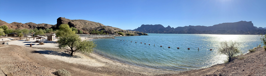
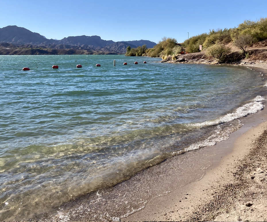
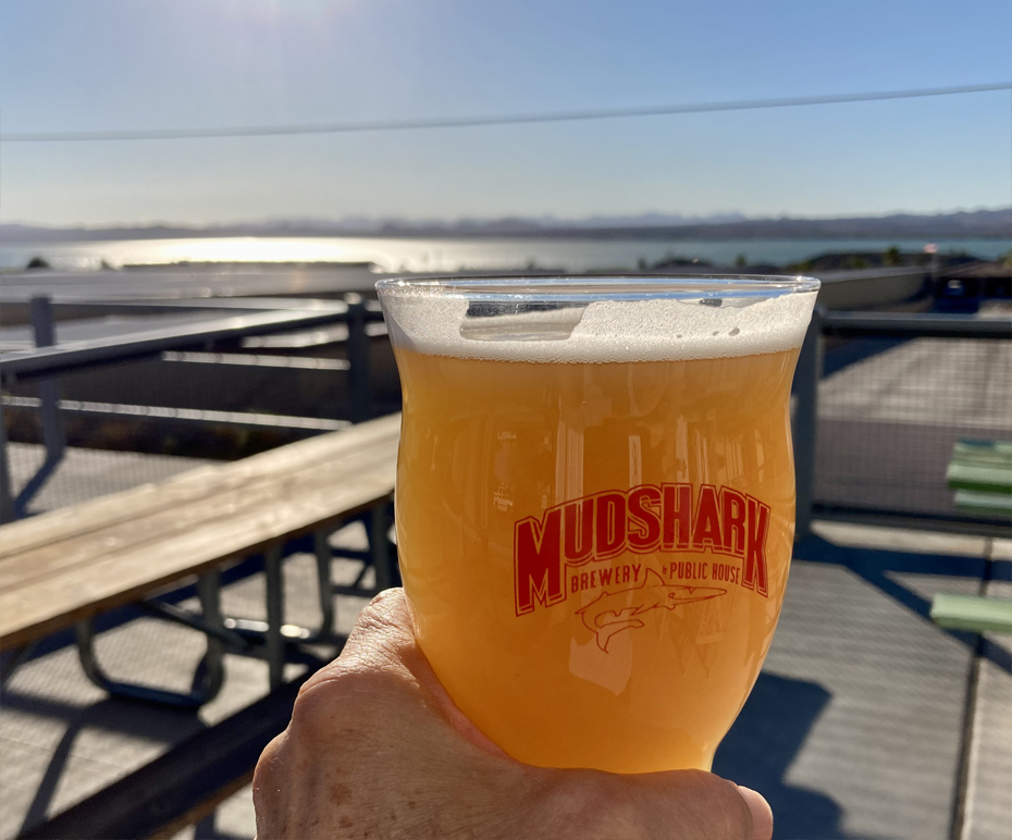
I left Tucson on November 11th, with an overnight in Lake Havasu City, AZ. After several unexpected traffic delays, and a short stop at Cattail Cove State Park, I checked into the Island Suites Hotel around 3pm, unpacked, then headed out for a beer at Mudshark Brewing Company. Alastair had I had been there years ago when it was in a strip mall on Swanson Avenue – the new location has an outside patio with a view of the lake, which is where I enjoyed my IPA. On the way back to the hotel, I stopped at Lake Havasu State Park for short walk before sunset. It was quite windy, but the light was beautiful and temperature still around 80F.
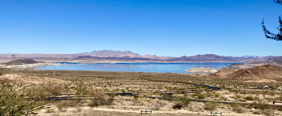
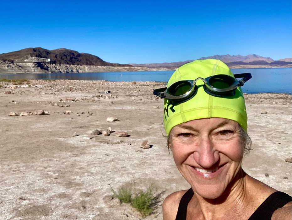
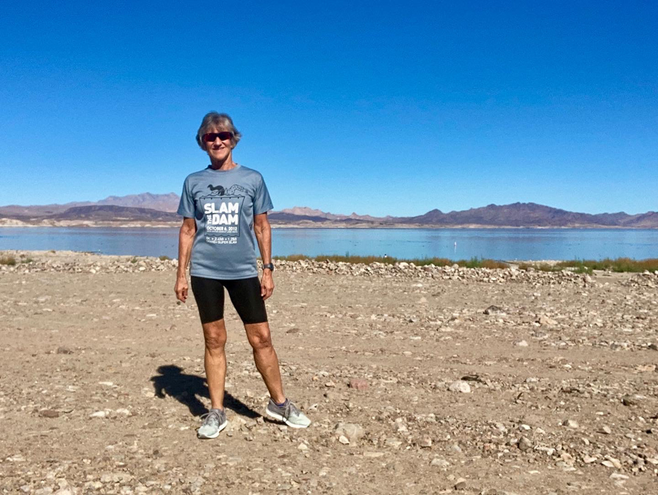
The next day, I went out early for a walk at the Rotary Community Park, a popular place with locals. I was checked out of my hotel by 9am, and drove via Kingman to Lake Mead for a swim and picnic lunch. The last time I was at Lake Mead was in October of 2012 for the Slam the Dan 8k Swim. I had read that Lake Mead is at its lowest level since the Hoover Dam was built in the 30s, but it was still shocking to see. I parked at Boulder Beach, and walked a considerable distance from the parking lot to the water – far longer than in 2012. Nevertheless, I enjoyed my half hour swim – the water temp was @68F (no wetsuit needed) and it was clear enough to see fish at the bottom, about 15 feet beneath me.
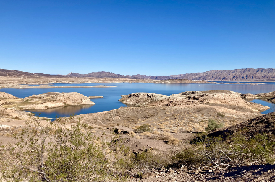
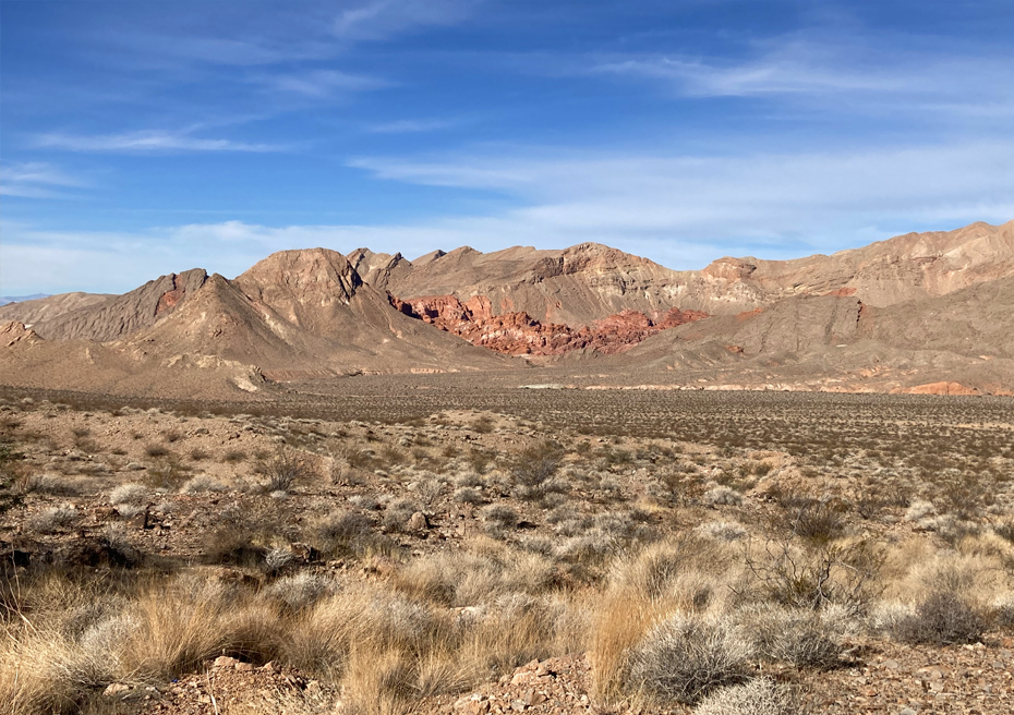
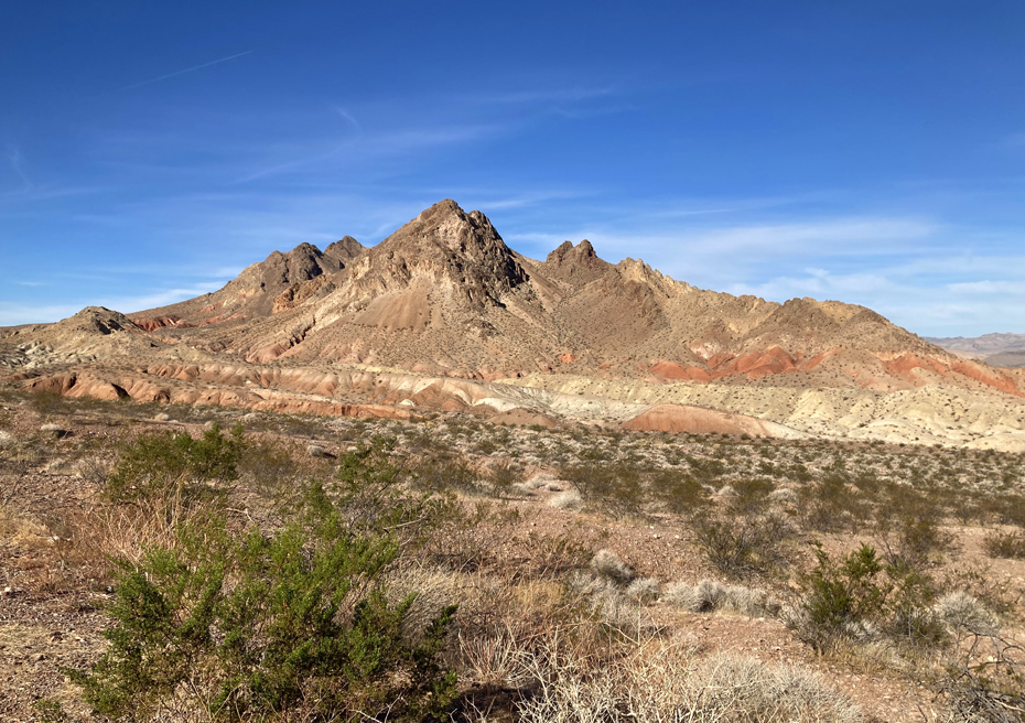
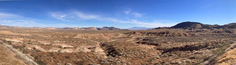
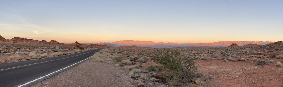
From Lake Mead, I drove up Northshore Road, which is all within the Lake Mead National Recreation Area. It’s a beautiful and relaxing drive. The topography is a result of the Basin and Range deformation, which has exposed millions of years of geologic history. A nice summary of the geology of the area by the National Park Service can be read on their website.
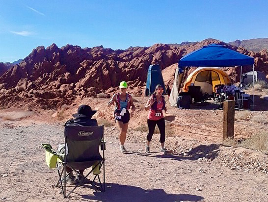
I checked into my hotel in Overton late afternoon, and then went out to the race start area that evening for packet pickup. A large number of participants were camping at the start area, many of whom I assumed were the ultra distance runners who would start the next morning at 4am. I was back in my room by 7pm, had something to eat, did some stretching, and was asleep by 9.
Saturday morning I was up at 3:30, an hour before my alarm was set to go off. I did a short yoga session, had my prepared breakfast (oats, protein powder; chia seeds, flax meal, cinnamon, pea protein milk, and coffee), and then finished packing up my race gear.
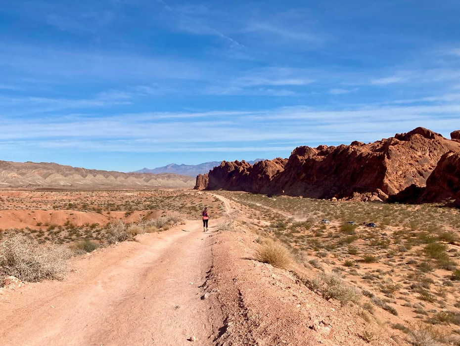
At 8am, I was among 28 people that started the 10k. It was slow going the first quarter mile down a rocky path, but it soon leveled out and I could pick up the pace. Typically, I walk/run (having always trained using the Jeff Galloway method), but I felt good physically and mentally so I kept running and didn’t take a walk break during the first couple miles. The course wasn’t as challenging as I’m used to, with less than half the elevation gain that I would normally do in the same distance. I was pleased to achieve a PR with a finish time was 1:24:03.
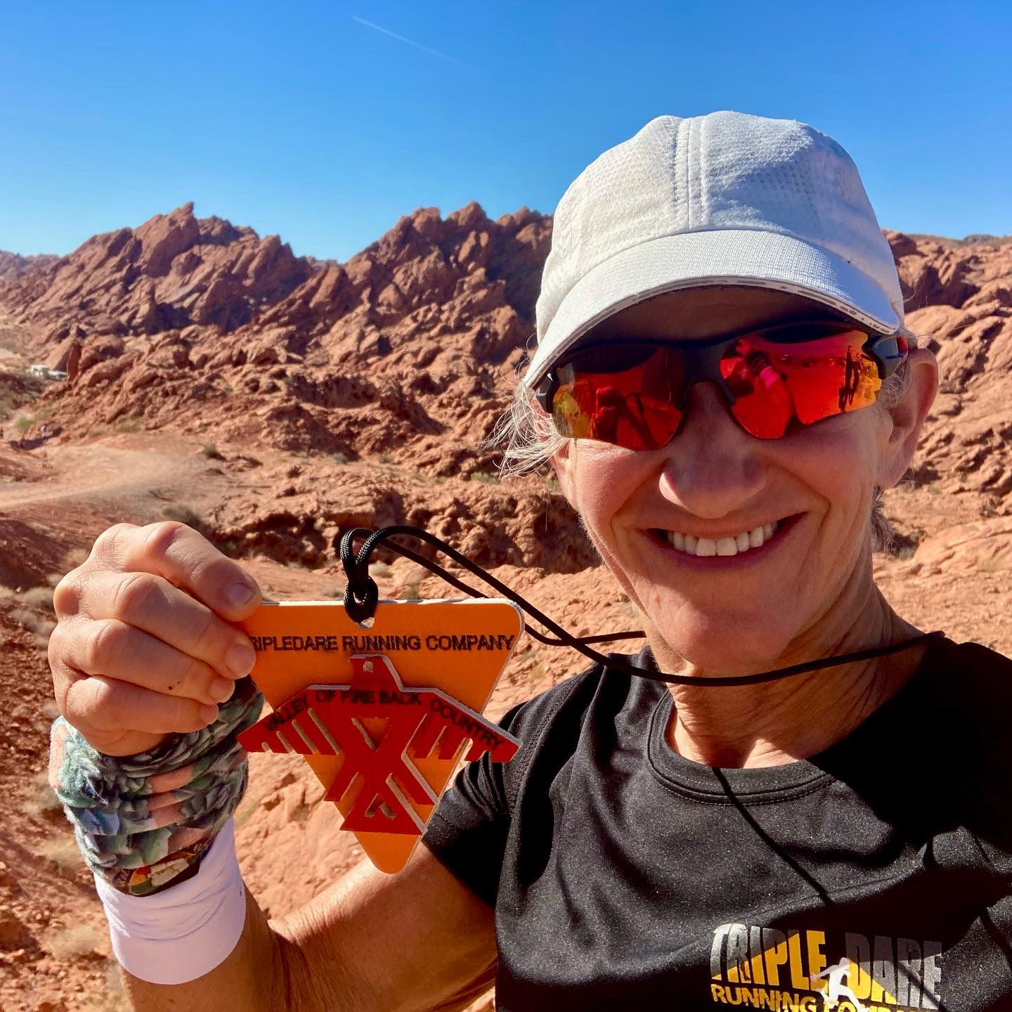


The following day I was back at the race start at 6:30am for a 7:30 start. There were 32 people in the half marathon, and I was toward the back of the pack going across the start line. I was glad to have experienced part of the course the day before, it helped me relax and set a comfortable pace. Most of the group pulled ahead quickly, but there was one woman who was running about the same pace as me, although stayed ahead of me until we got to the halfway aid station. Both of us quickly grabbed a snack and started back with little delay. I started talking to her and from that point on we ran together. Michelle is a high school geosciences teacher in Las Vegas and was a wonderful companion. The remaining time seem to pass quickly. I crossed the finished line with her, setting another PR with a finish time of 3:15:00. Cassie was waiting for me – we had agreed to have lunch together after the race. I really enjoyed the event and all the people I met, and would consider coming back next year to do the full marathon!


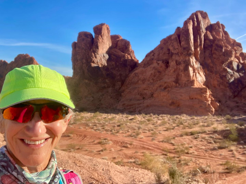
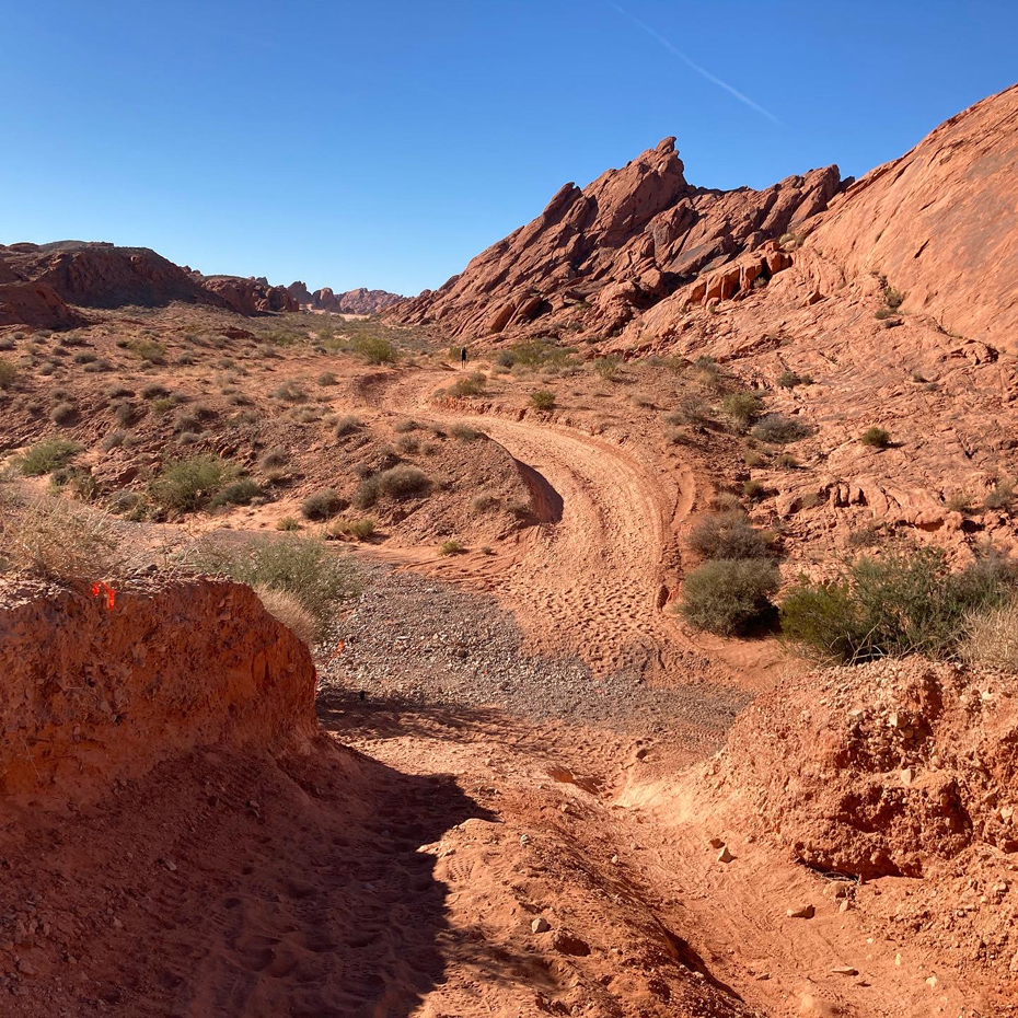
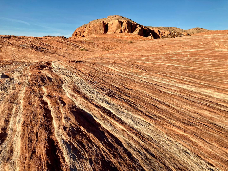
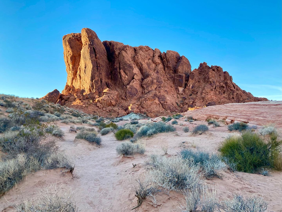
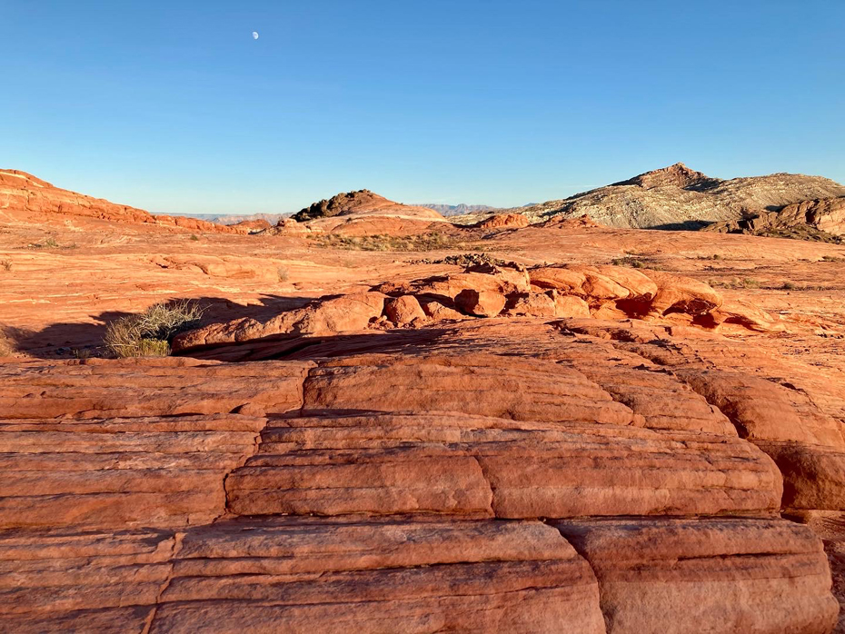
After lunch and getting cleaned up at my hotel, I still had some energy so took a drive south to the Valley of Fire State Park. It was getting close to sunset, but that left enough time to do one short hike. I chose the First Wave Trail. Beautiful!
On Monday, I traveled to Prescott, AZ, where I stayed the night. Prescott is 55 mi west-northwest of the State of Arizona’s geographic center. The town was founded in 1864, and an area near the center of town quickly accumulated saloons and other entertainment venues, becoming known as “Whiskey Row.” I was hoping to check out the area that evening, but I was quite tired from the weekend, plus I had planned to do a couple more hikes the next day, so I turned in early.
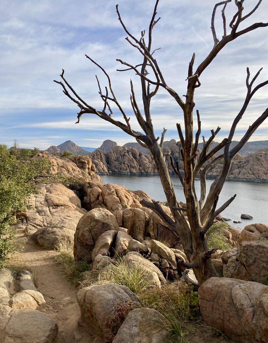
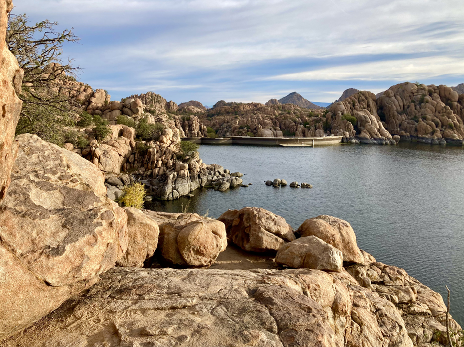
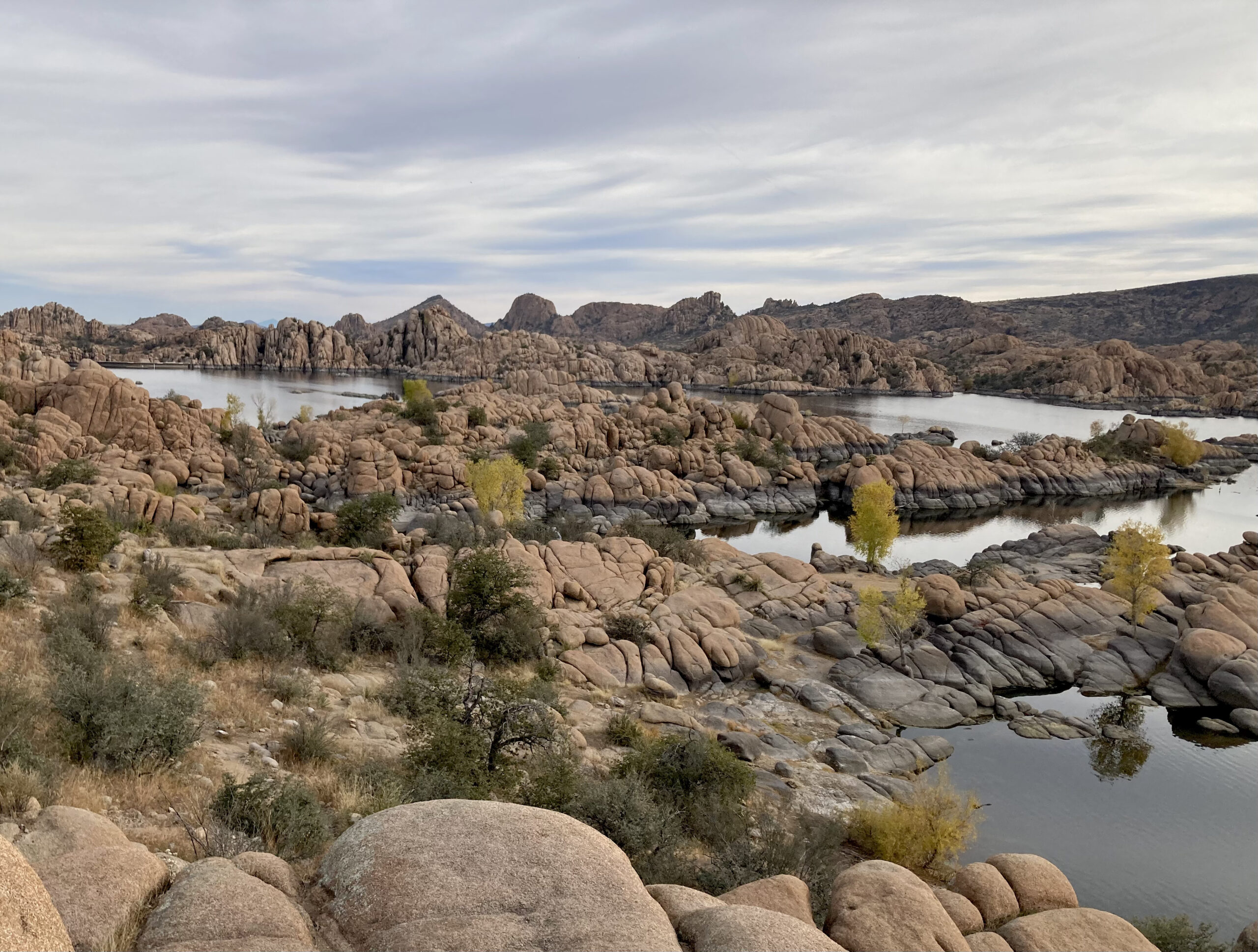
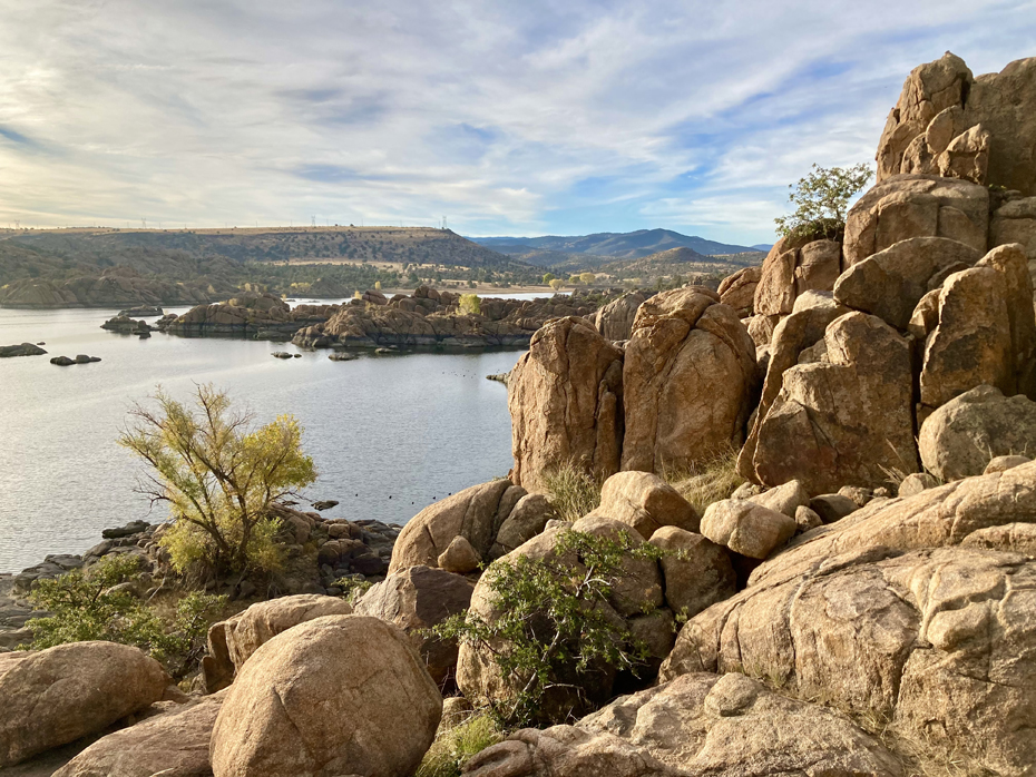
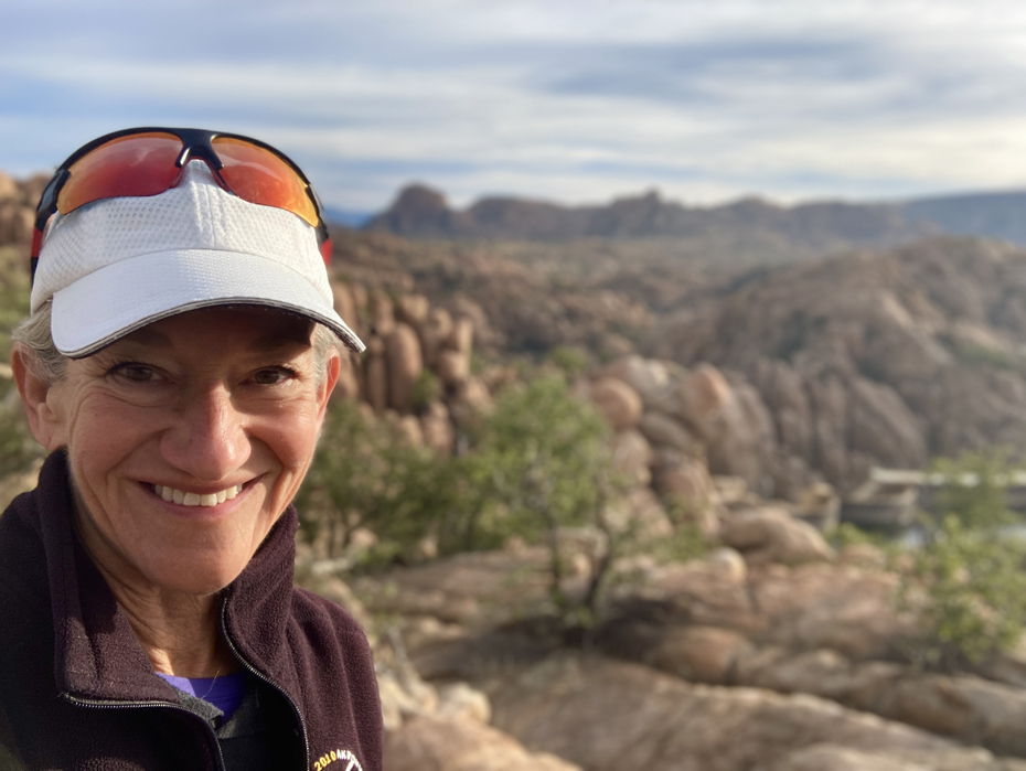
I arrived at Watson Lake shortly after sunrise, and went out on the lake loop trail for about an hour. Well worth the trip – very unique! Watson is a man-made reservoir with a water surface of 380 acres, known for the large boulder outcroppings of granite. I can understand why the area is so popular among rock climbers.
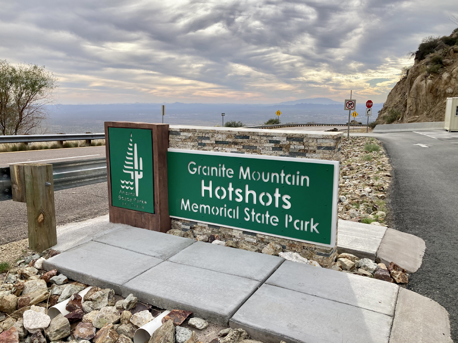
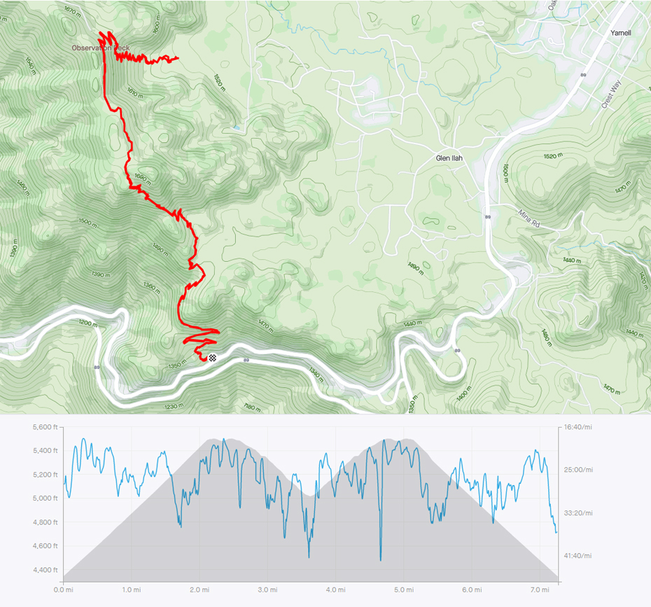
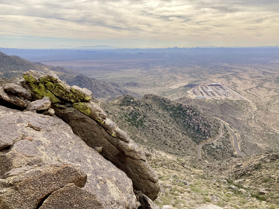
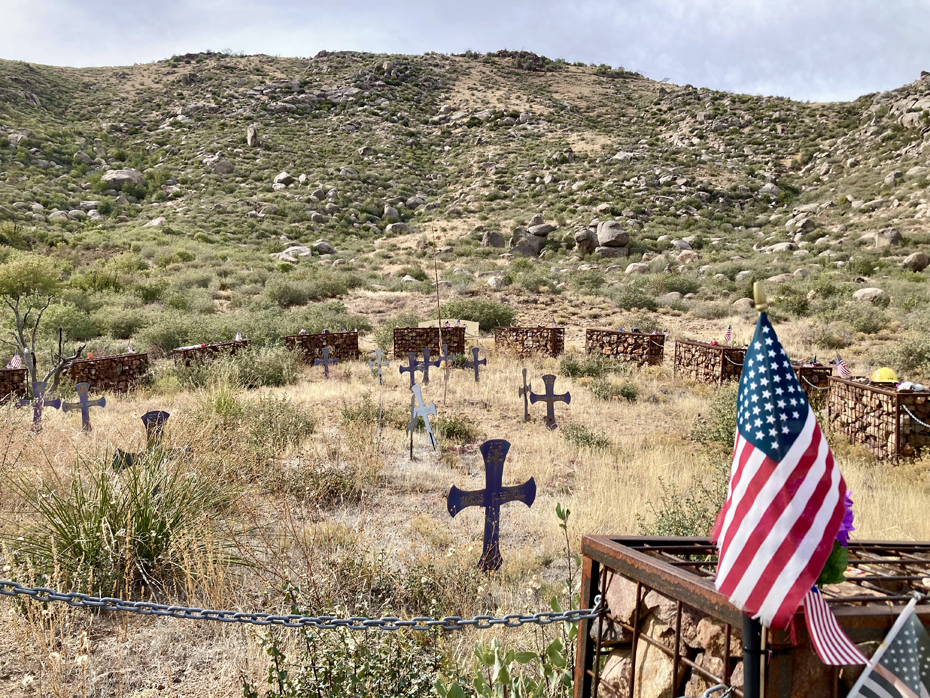
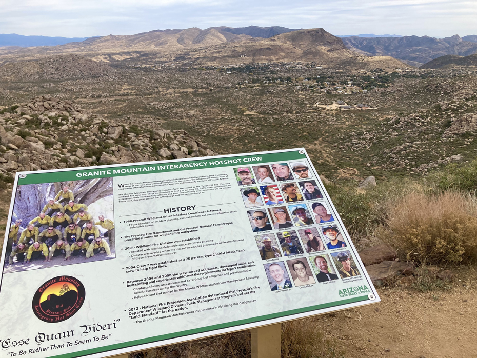
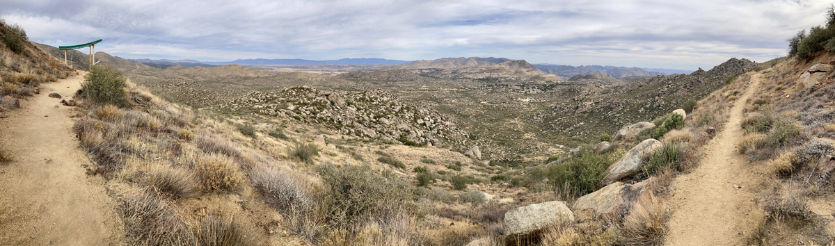
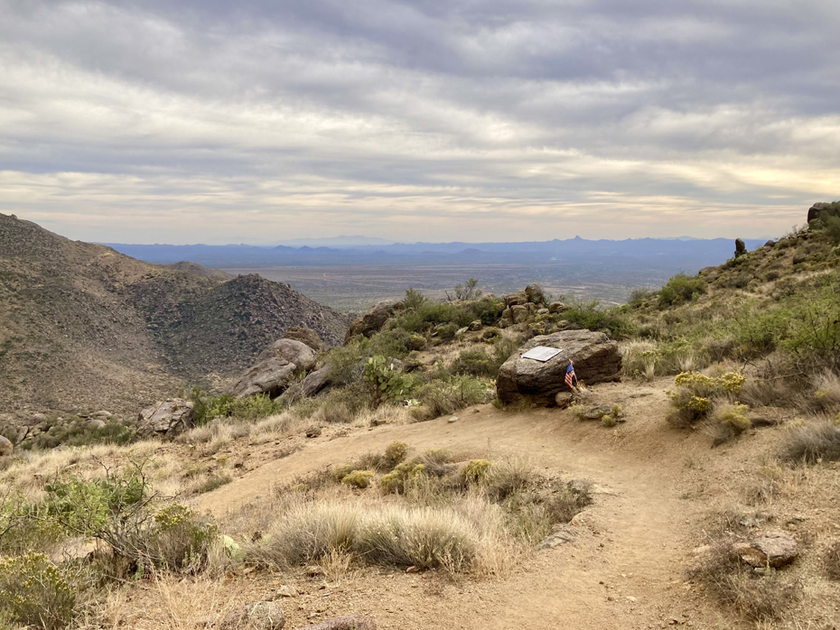
My last hike before heading home was at the Granite Mountain Hotshots State Park, just outside the town of Yarnell. The park was dedicated in 2016 as a place to remember the 19 Granite Mountain Hotshot Firefighters who died on June 30, 2013, while fighting the Yarnell Hill Fire. From the trailhead, you hike 2.85 miles up to the observation deck. Along the way, there are 19 granite plaques set into rocks that share a photo and a story of each fallen Hotshot. From the observation deck, the 3/4-mile Journey Trail allows you to follow the last steps of the Hotshots down to the Fatality Site where they made their last stand. Encircling the Fatality Site, 19 gabion baskets, one for each Hotshot, are united by chains representing their eternal team. Read more about the men on the AZ State Parks website. The roundtrip hike was 7.25 miles with about 1700 feet of elevation gain. It was one of the most emotional hikes I’ve ever done! Arizona State Parks did an incredible job building the trail and all the memorials.